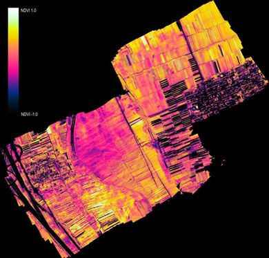
Intelligent, accurate and professional aerial survey is the best solution for the market, using "Advanced Analytics" technology for the field of Plantations and Industry
Our professional and accurate RPAS (Remotely Piloted Aircraft Systems) Service is the best solution available for the Precision Agriculture, Viticulture, Forestry and Construction market.
We have UAV systems, advanced payloads and proprietary image processing post-processing software that set us apart from the competition and allow us to efficiently carry out the most demanding aerial surveys in Portugal.
We incorporate the experience of our partners with more than 1,000,000 hectares surveyed and processed. We master advanced methodologies, processes and tools that ensure the safety of missions, better control of the workflow in progress, carry out work efficiently in space and time with delivery of reports in time with the highest industry standard. We provide intelligent reports that are an important decision support tool in the early detection of human and natural threats.
Image capture with our RGB and Multispectral sensors (6 bands) allows high resolution terrain mapping and accurate aerial assessments.
We have the capacity to carry out parallel processing of a large amount of data and we are able to provide our customers with web-based geographic information system that allows all stakeholders to have useful views of large land areas. With this solution, business decision makers can better respond to potential threats, make timely decisions and intelligently manage soils and / or buildings to optimize business production and profitability.
OUR MARKET

Forests
The Forest represents a key asset, both nationally and globally. With the professional aerial survey we are able to capture data (RGB and / or Multispectral).
Orthophotomaps, 3D maps, with tree counting algorithms, among others, can be produced.

Agriculture
Our services help specialists and agricultural companies to make well informed decisions.
Our job is to listen to the customer's needs and develop a tailor-made solution.
Whether you are a consultant or an owner, our goal is to give you the data you need to make healthier and more profitable crops.

Construction
Reduce costs and increase productivity with smarter management of construction projects.
With professional aerial survey, you can:
-
Reduce the cost of earthworks;
-
Speed up construction planning and design;
-
Better monitor and manage construction progress.

Quarries and Extractive Industry
With our drone aerophotogrammetric surveys, we are able to capture crucial information for companies operating in the extractive industry.
The information collected by drone allows us to extract precise volumetric information, supported by a GNSS station. We provide 3D models, topographic precision maps, and the possibility of mapping several phases of the extractive process.


